Navigation
276 open source Navigation apps

GPSd Forwarder
APK
This application forwards NMEA data from your phone's GPS to a specified host. It's goal is to easily plug and feed data into a GPS server service (e.g. GPSd), using your cellphone as a GPS device. This way, your cellphone can be used as a GPS in navigation or robotics applications running in a host computer. Data is forwarded using UDP. First, make sure the computer's IP is reachable from your cellphone; this is the case in most default access points, so it should work if both are connected to the same WiFi network. On the host machine, execute `gpsd -N udp://:` (e.g. `gpsd -N udp://*:29998`). In the app, enter your host's IP and port and hit Start. Your host is now receiving GPS data forwarded from your phone. You can test it with gpsmon or other GPSd utilities.
F-DroidGitHub

GPXIT
APK
GPXIT helps cyclists who plan one-way bike routes and need to take a train home. Import your GPX route, and the app discovers train stations along your path. When you're ready to head home, it shows you the best options: which station to ride to, how long you'll wait, and when you'll arrive home. Features: - Import GPX routes (share from Komoot or any cycling app) - Automatic discovery of train stations along your route - "Take me home" — see all upcoming stations with cycling time, wait time, and connections - Search for nearby stations anywhere on the map - Detailed connection info with intermediate stops and changes - Navigate to any station via your preferred map app - Download map tiles for offline use - Configurable transport types (regional trains, S-Bahn, U-Bahn, tram, bus, ferry) - Optional ICE/IC/EC long-distance connections - Transit data via Deutsche Bahn (covers German and international connections) Privacy: - No tracking, no analytics, no accounts - All data stays on your device - Location is only used to show your position on the map - Internet is used only for map tiles (OpenStreetMap) and transit queries (Deutsche Bahn)
F-DroidGitHub

GSAK for Locus
APK
Do you know GSAK? GSAK is a geocache management program where you can edit the final waypoints, add notes or other auxiliary points or import / export geocaches. This add-on provides a link between GSAK where the geocaches are stored, and Locus, a great map application for Android. With this add-on, you can view all geocaches, you have stored in GSAK, display their listing and more. And all this offline without an internet connection! It's easy - install the add-on, copy the database to the smartphone, set the paths correctly, run Locus and just import the geocaches.
F-DroidGitHub

Gadgetbridge
APK
Use your smart watch, fitness tracker, and other Bluetooth devices without the vendor's closed source application and without the need to create an account and transmit any of your data to the vendor's servers. For a full list of supported device, please refer to our Gadgets page https://gadgetbridge.org/gadgets/. You can get notifications on your wrist and (depending on the device): - Collect data from the device sensors. - Control music playing on your Android device. - See the weather. - Get directions.
F-DroidIzzyOnDroid

Gas Prices
APK
Gas Prices Germany provides the prices that the petrol stations report to the market transparency office. You can choose your own locations and get current gas prices. Clicking on a gas station in the list or on the icon in the widget shows the gas station in an external map application. You can also allow the app to use GPS. If you do so and have the app widget installed the position will be updated from time to time and the first tab in the app and the widget will show gas stations for your current location. (This will overwrite the city in your first tab.) You can also enter your favourite brands in settings. In this case the list in the app will mark your favourite brands with a star and the widget will show the closest station of one of these brands if available in the search radius. You can set your preferred fuel type. In this case it is also possible to sort results by price. The data is provided via the Tankerkönig API under the Creative Commons license “CC BY 4.0” from www.tankerkönig.de. Minimum permissions: Gas Prices only requires the minimum amount of permission, namely only the INTERNET permission. This permission is necessary to make HTTP requests to remote servers for retrieving gas prices. Optional: authorization for GPS.
F-DroidGitHub

Geo Share
APK
Share a map link with Geo Share and the app will open it in another installed map app. Supported map links - Google Maps - Apple Maps - 2GIS - Amap (AutoNavi) - Baidu Map (beta, no short links) - CoMaps - HERE WeGo - Magic Earth - Maps.me - Mapy.com - OpenStreetMap - Organic Maps - OsmAnd - Urbi - Waze - Yandex Maps - coordinates Example use cases When someone sends you a Google Maps link, but you prefer using OpenStreetMap, you can quickly open the same location in OsmAnd or Organic Maps. When you like Google Maps for finding places, but you prefer a different app for navigation, you can easily switch from Google Maps to your favorite navigation app. Other features - Shows the geographic coordinates of a map link and allows copying them to clipboard in various formats, for example as a geo: link. - Shows all points of a place list link. - Allows performing an action automatically when a map link is processed. - Allows launching navigation in TomTom, Waze, Magic Earth... - Allows saving a location as a GPX file. - Retries on patchy internet connection. - Allows pasting map links directly into the app, instead of sharing them with it. - Interface adapts to tablets. How it works and privacy considerations Geo Share converts map links (e.g. https://maps.app.goo.gl/...) into geo: links that can be opened by other map apps. To create a geo: link, geographic coordinates are required. Geo Share extracts them from the map URL. However, not all map URLs include coordinates. In such cases, Geo Share will prompt you for permission to connect to the map service (Google Maps, Apple Maps etc.) and retrieve the coordinates from either HTTP headers or the HTML document of the link. For more detailed information, check the app’s FAQ screen.
F-DroidGitHubIzzyOnDroid
GeoGas
APK
GeoGas allows users to locate the cheapest gas stations in their area, facilitating fuel savings through a geolocation system and real-time price comparison.Key Features:Automatic Geolocation: Detects your location and shows the nearest gas stationsPrice Comparison: View up-to-date prices for gasoline, diesel, and other fuelsAdvanced Search: Filter by fuel type, distance, and hoursFavorites System: Save your favorite gas stations for quick access
GitHubIzzyOnDroid

GeoKrety Logger
APK
GeoKrety is a non-commercial GeoCaching game. People move registered objects (called GeoKrety) from cache to cache and register each move with the service. For more information please visit the website. You'll need account on the website to use the app. How to log GeoKret's movement: Click the button "Log GeoKret" on the main screen. Select the type of the log. Make sure that in the "Identify GeoKret" is your login. If you had met or grabbed the GeoKret, fill in it's tracking code. If you drop the GeoKret, you can click "Inventory" and choose Tracking Code from the list of GeoKrets in your inventory. If you had dropped or met GeoKret, you have to fill in the Waypoint. If you had logged to the cache before, click the button "OC Log" and select waypoint from the list (the date and time will be pasted too). Set date and time, enter some comments and click "Go!".
F-Droid

GeoNotes
APK
A simple app to create and manage georeferenced notes (text and photos) on a map. The goal is to create the notes very fast and without any unnecessary interaction overhead. The typical use-case is to collect geospatial data which can be later uploaded to OpenStreetMap. Currently the basic features are: Create, move and delete notes on a map Attach photos to a note Categorize notes List of all notes Show and follow current location Export all notes in GeoJSON or GPX format Hozzon létre és állítson vissza teljes biztonsági másolatot
F-DroidGitHubIzzyOnDroid
GeoShare: Jump Between Maps
APK
Share a map link with GeoShare and the app will open it in another installed map app. Supported map links - Google Maps - Apple Maps - 2GIS - Amap (AutoNavi) - Baidu Map (beta) - Cartes IGN - CoMaps - HERE WeGo - Magic Earth - Maps.me - Mapy.com - OpenStreetMap - Organic Maps - OsmAnd - Plus Codes (global only) - Urbi - Waze - Yandex Maps - coordinates Example use cases When someone sends you a Google Maps link, but you prefer using OpenStreetMap, you can quickly open the same location in OsmAnd or Organic Maps. When you like Google Maps for finding places, but you prefer a different app for navigation, you can easily switch from Google Maps to your favorite navigation app. Other features - Shows the geographic coordinates of a map link and allows copying them to clipboard in various formats, for example as a geo: link. - Shows all points of a place list link. - Allows performing an action automatically when a map link is processed. - Allows launching navigation in all apps that support it, including TomTom. - Allows opening a location in web maps, pre-installed ones or your own. - Allows saving a location as a GPX file. - Allows sending a location via a messaging app. - Allows saving a location to a contact. - Retries on patchy internet connection. - Allows pasting map links directly into the app, instead of sharing them with it. - Interface adapts to tablets. How it works and privacy considerations GeoShare converts map links (e.g. https://maps.app.goo.gl/...) into geo: links that can be opened by other map apps. To create a geo: link, geographic coordinates are required. GeoShare extracts them from the map URL. However, not all map URLs include coordinates. In such cases, GeoShare will prompt you for permission to connect to the map service (Google Maps, Apple Maps etc.) and retrieve the coordinates from either HTTP headers or the HTML document of the link. For more detailed information, check the app’s FAQ screen.
F-DroidGitHubIzzyOnDroid

Geotag video camera
APK
An app which displays an overlay of a map along with the coordinates on screen which can be used via screen recordings (uses mapbox or geoaplify apis). Have tried manual video recording options but the overlay wouldn't get saved to the final recording properly or needs frame by frame processing to insert the overlay which would be resource intensive. Double tapping the screen opens up the settings menu where the geoapify and mapbox api keys can be inserted. You will have to create an account and just add the api key from the website. (Have tried various leaflet options but none of them worked as intended..) FEATURES * No ads (Almost all of the play store ones have ads in them) * FOSS * Clean, fast and lightweight HOW TO USE * Just record your screen or take a screenshot to get the photo or video with the overlay.
F-DroidGitHubIzzyOnDroid

GetBack GPS
APK
Features: determine location based on GPS signal, WiFi or cell phone network: use best/most accurate location provider get location updates automatically (based on a time interval or change of location) or get location on demand (by manually refreshing) save current location as destination add a destination with manual coordinates 'get back' mode: indicator pointing to a stored location (showing distance and direction) indicate current speed and current bearing use built-in sensors to get more accurate and quicker updated bearing a compass rose that points to the North detect travel direction and adjust relative direction to destination accordingly Available languages: Basque Belarusian Catalan Chinese (Traditional) Chinese (Simplified) Croatian Czech Danish Dutch English Estonian French German Hebrew Hindi Hungarian Italian Indonesian Japanese Kabyle Korean Norwegian Bokmål Persian Polish Portuguese (Brazil) Portuguese Romanian Russian Sardinian Spanish Turkish Ukrainian Is your language missing? Help translating.
F-DroidGitHub

Gore Companion
APK
View trail, snow, and lift status of Gore Mountain in NY, USA.
F-DroidGitHub

Gps Icon
APK
Before Kitkat, The GPS icon in the status bar reflected whether your device was still searching for satellites or already had acquired a fix. With Kitkat, this no longer was the case – but an XPosed module named GPSNotification fixed that. This module is no longer working with Lollipop – which is where Gps Icon comes into play. Thanks to this little app, you again can see the GPS status in your status bar.The developer of GPS Icon doesn’t want an app which needs less than 50kB to do its job inflated to 500kB or more just because of drawing in the „usual frameworks“ – so it sometimes takes a bit of playing around to have it working on as many Android versions as possible. Version 1.3.0 worked well for a long time – but no longer for Android 8 (Oreo). Attempts to get that working broke it for either Android 6, 7 or both – so after the experiments, we decided to keep 3 versions:v1.3.1: a special old version, actually created after v1.4.3, based on v1.3.0 and made working for Oreov1.4.2: version with new features but before „Oreo hacks“ (i.e. probably not working on Oreo)v1.4.6: version with new features which now hopefully works for all aforementioned platforms (but no longer with Android 10)Should there still be any issues, please report!
GitHubIzzyOnDroid

GraphHopper Maps
APK
GraphHopper Maps is an online route planner based on OpenStreetMap data and open source software. It calculates routes and alternatives very fast. It supports several modes of transport like car, bike, hiking, walking and more. You can add multiple stops to your route and on bigger screens view the road attributes like elevation, surface or max speed for that route. Read more: https://www.graphhopper.com/maps-route-planner/ After you calculated the route and your GPS location is enabled you can start the GPS navigation which guides you to your destination. Note, that this is an experimental feature. Understand that you are using this free application at your own risk and it comes WITHOUT WARRANTIES. See the Apache license 2.0 for more details. The provided instructions might be illegal or dangerous. Please always follow the local rules and regulations. As GraphHopper is open source you can host the complete stack on your own servers. See github.com/graphhopper/graphhopper for the routing engine, github.com/onthegomap/planetiler for the map tiles, github.com/komoot/photon for the geocoding and github.com/boldtrn/graphhopper-maps-capacitor for the front end. If there is an issue please use the issue tracker of the front end or send us an email: navi-feedback@graphhopper.com. Please include the version and if possible use the most recent application version and include the log information.
F-DroidGitHub

HK Transport
APK
HK Transport makes use of data from HK gov In the app, you can find data of - Bus - MTR - Minibus - Tram(Estimated time of arrival not available) - Light Rail - Ferry(Estimated time of arrival not available) License: GPL v3.0 or later Webapp Version: https://hk-transport.12a.app
F-DroidGitHub

HUD
APK
This app converts your Android phone into a simple, clear HUD for your car displaying momentary velocity as measured by your GPS. Lodge it between the windshield and the dashboard. Usable mainly during the night. Occasionaly you may see these alerts: * OFF - location access is turned off * NFX - no fix (yet) * NAV - not available (GPS engine status) * LAG - GPS speed did not update since at least 2500 ms
F-DroidGitHub

Haltestellenanzeige (Display Monitor)
APK
This app is intended for commuters who use the same stops every day. A departure monitor can be created for each stop, either in the app itself or through widgets. All stops in Germany are supported, some even with delay information
F-DroidGitHub
H
HardWhere
APK
Snipeit-It asset management mobile app. Supports the additon of who-lent-to-whom, which requires running a custom backend provided by the same repository as this app.
F-DroidGitHub
H
Hauk
APK
Hauk lets you share your location in real-time with friends and family for a specified period of time. Meeting up with someone? Send them a Hauk link, and they can follow your location live on a map until you arrive to meet them. This app requires that you have installed the Hauk backend on a server. Please see https://github.com/bilde2910/Hauk for backend installation instructions. Required permissions: * ACCESS_FINE_LOCATION - for getting your location, so that it can be shared * FOREGROUND_SERVICE - for keeping the share running when the app is minimized * INTERNET - for communicating with your Hauk backend server Hauk does not share your location data to anywhere except the Hauk backend server you specify within the app. A unique link will be generated for your location share when you start sharing; anyone with this link will be able to see your location in real-time for as long as you are sharing.
F-DroidGitHub
H
Heading Calculator
APK
Calculate true heading (TH) and ground speed (GS) of an aircraft from given true airspeed (TAS), true course (TC), and wind direction and speed (WD/WS).
F-DroidGitHub

Helsinki Timetables
APK
Helsinki Timetables provides Timetables of public transport for Helsinki city and regions, Finland. The app supports the following languages: Languages: eng, fin, rus, fra, esp, est, swe, vie Note: this app requires about 75MB free space on SD-card (sometimes more, when database keeps all timetables from summer and winter periods).
F-DroidGitHub

Here GPS Location
APK
Small app that shows you the current GPS coordinates.
F-DroidGitHub
Hikar
APK
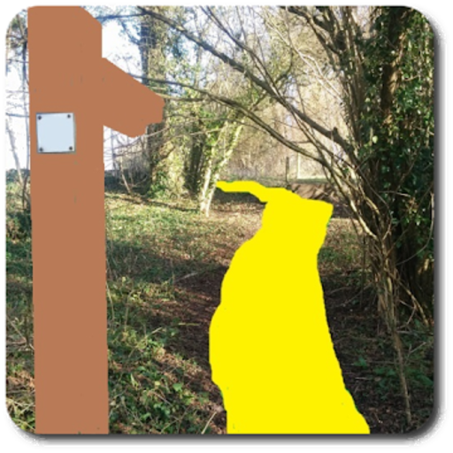
Hikar is an augmented reality app for Android (4.2+) which overlays footpaths from OpenStreetMap on the device's camera feed and shows virtual signposts. Its aim is to help navigation for walkers/hikers (hence the name) and other outdoor users. For example, imagine you are entering a large field and it's not clear where the exit is. Hikar will overlay the course of the footpath on your phone's camera feed helping you to navigate across the field. Or, you're at a junction of paths and it's not clear which is the correct way. Hikar will show a virtual signpost, showing the direction and distance of nearby points of interest such as villages, hills, mountains or pubs. Or, you're having to make your way across a pathless moor. Again, Hikar will help you find the way. Hikar covers the whole of Europe, plus Turkey. It could potentially work in any area which uses Roman, Greek or Cyrillic characters, but the Hikar server (also FLOSS software: see gitlab.com/nickw1/freemap-api) currently only contains data for the specified areas. Note that Hikar is a research project and therefore, while perfectly usable for navigation it is not a 'polished' app with a really nice UI and, like many AR apps, can use a lot of battery power. Please note, that for a currently-unknown reason, Hikar will not run on the Amazon Fire HD 10 (and possibly other Amazon Fire devices). Many thanks to my colleague Neil Brewis for providing the signpost assets.
F-Droid